 | Black-faced spoonbill
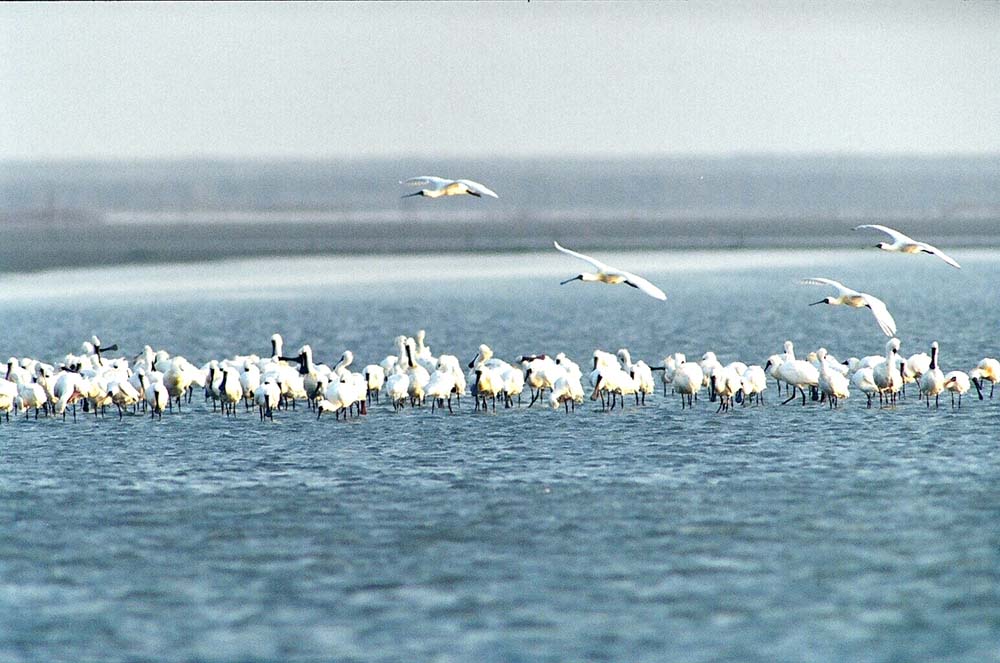
The most valuable species of Taijiang National Park and Cigu The Black-faced spoonbill is an endangered migratory bird species that belongs to the Threskiornithidae family. Its biggest features are its unique beak that flattens and broadens at the tip to form a shape that looks like a spoon or a pipa (the Chinese lute), as well as its black colored brows, faces, and edges of the maxilla. The adult bird measures about 74 cm long. Birds that first arrive at Taiwan only weigh about 200 to 300 grams. These birds would feed voraciously, increasing their body weight to about 700 to 800 grams before they embark for their return journey north for the subsequent breeding season. During winter, the bird would assume an entirely white plumage. Semi-adult birds would have black margins along the wing feathers. During the breeding season (spring and summer), the birds would have
yellow-colored crown feathers and down feathers that encircle its neck. Every early October, the black-faced spoonbill will start migrating southwards from their habitats of rocky islands west of the Korea peninsula, Siberia, and northeastern China. Major wintering areas for these birds would be the areas around Cigu Lagoon. Some black-faced spoonbills would also winter in southern China, Hong Kong, and Vietnam. Flocks of the spoonbills would also feed around the fisheries to stock up on energy and fat so that they would have the energy to make the return trip northwards in April to breed. Black-faced spoonbills would flock as they return to their roosting areas or leave for feeding. Bird watchers using high-powered binoculars would be able to observe these birds resting in their roosts or standing in rows against the wind. In 1974, there were just over 20 individual black-faced spoonbills at the mouth of the Zengwen River. This population has slowly increased over the years and by 2010, there were about 1200 spoonbills in the area, making Cigu the wintering location with the highest number of spoonbills. There are 2 major reasons for black-faced spoonbills to make their long migration southwards (for well over a thousand miles, or 1600 km) from North Korea and northeastern China and to winter along the northern banks, shallow intertidal zones, and wetlands of the Zengwen River in Cigu. The first reason is that the area is safe, with coastal protection features on 3 sides and a large shallow-water wetland in the middle. Other species (including people) are not able to approach them easily. The second reason is that there is plenty of food to be found here. The eastern, southern, and northern regions outside the levees are covered by fish rearing ponds. During the dry winter, the ponds would be reduced to shallow pools that are populated with numerous small fish and shrimps, making them a perfect feeding area for the spoonbills to stock up on their reserves for the return journey northwards.
Cigu District is especially blessed that the black-faced spoonbill, a species with the global conservation status, has decided to choose Cigu Lagoon as their wintering area. Cigu Lagoon is a pristine Eden where men and birds can co-exist peacefully and serves as a valuable world-class ecological resource. The Lagoon is the pride of Cigu residents. |
 | Cigu Salt Pans
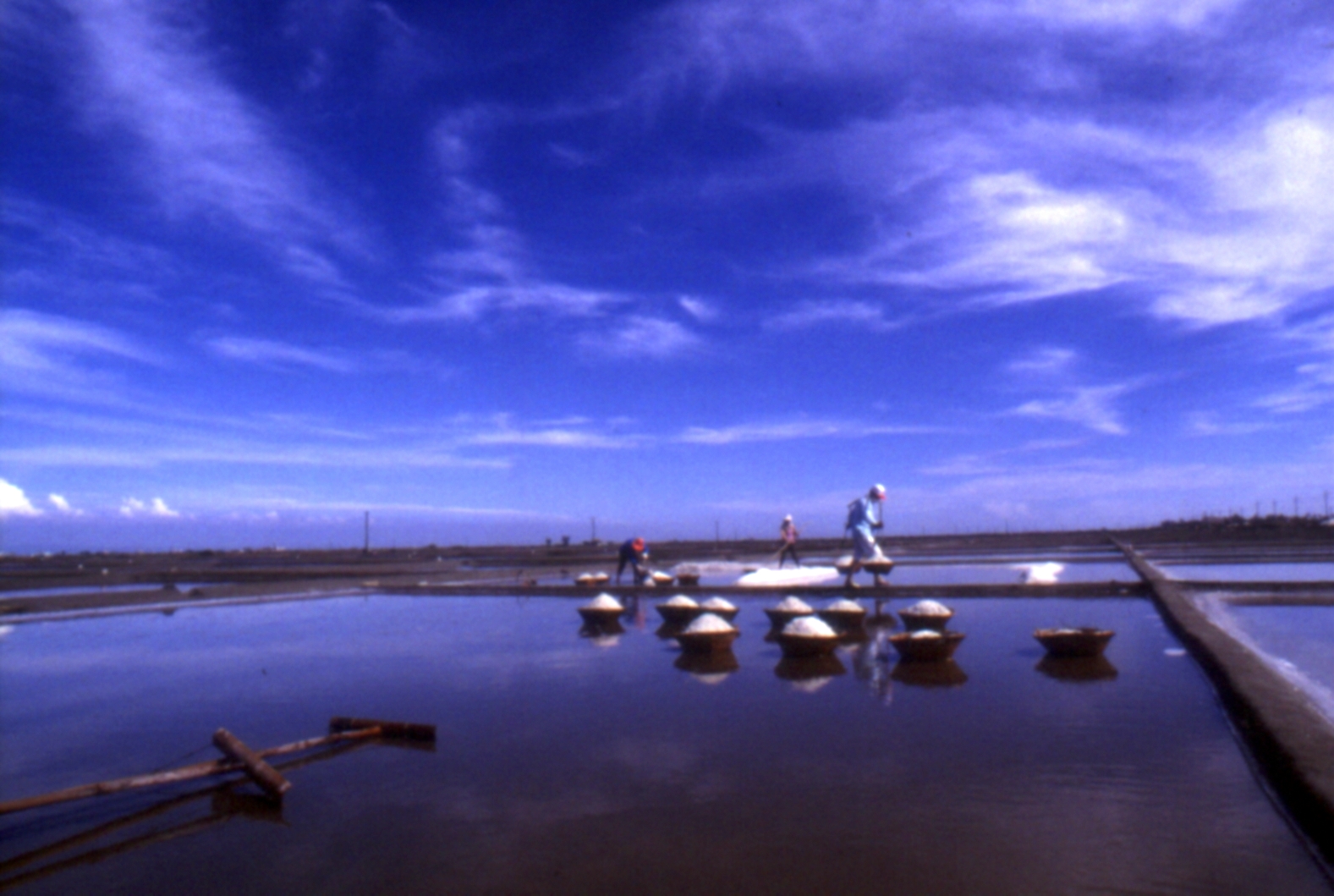
The coastal areas from Beimen District at the northwestern-most corner of Tainan to Cigu District in the southwest are covered by a broad expanse of salt pans. These salt pans make up the site of salt production in Taiwan. The salt pans at Beimen and Cigu Districts have always been key salt-producing locations in Taiwan. These salt production sites occupy an area of 2100 hectares and generate up to 60% (110,000 tons per year) of the country's total salt production. Salt workers would direct sea water into the salt pans during the dry season from October to March. Salt workers are exposed to sea water, salty winds, and the blistering sun. Their work is hard, with the womenfolk shoveling the salt and the men carrying the salt upon shoulder yokes, piling basketfuls of salt until they create an impressive salt mound.
The raw salt obtained by evaporating sea water can be used for farming, fishing, and industrial purposes. But this salt must be washed and crystallized to create table salt. In response to market requirements, low-sodium salts, iodine-free salts, and bathing salts have also been developed. Manual salt panning, however, is costly and easily affected by the climate. There's also the additional concern of land resource utilization. Taiwan thus began importing salt and developing salt resources with other countries. Perhaps in a few years’ time, the salt pans would be reduced to a part of our memories. |
 | Dujia Ancestral Worship
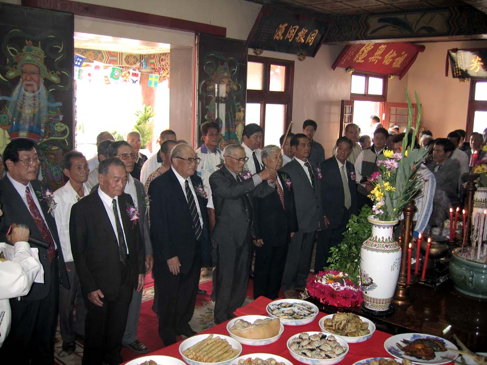
Dujia is a fishing hamlet located at the northwestern area of Cigu District. Almost every resident of Dujia hamlet is a member of the Qiu Clan, making Dujia a classic example of a village dominated by a single clan. In the morning of dongzhi (winter solstice), the villagers would begin a rite to venerate their ancestors at the ancestral house of Longtian Citang
(dragon field shrine). The ritual would be conducted by the Borough Chief. All newborn children and newlywed couples must come forth and pay their respects to their ancestors in the Renzu Guizong (acknowledging their ancestry) ceremony that symbolizes the eternal cycle of life and continuity of the clan heritage. |
 | Seaside Observation Deck
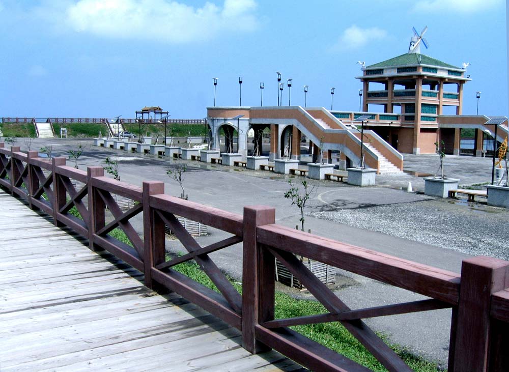
Seaside Observation Deck is a 3-story tall building located in the middle of the eastern levee of the lagoon. The deck used to mark the location of the salt pans belonging to TAIYEN company which occupied an area of 2.21 hectares. Neighboring facilities include a patrol station and a watchtower of the Coast Guard Administration. Surrounding amenities include wooden paths leading to deck and wooden gazebos. This is Cigu Lagoon's prime location for viewing the region, its oyster beds, the beautiful backshores, and the wonderful sunsets. |
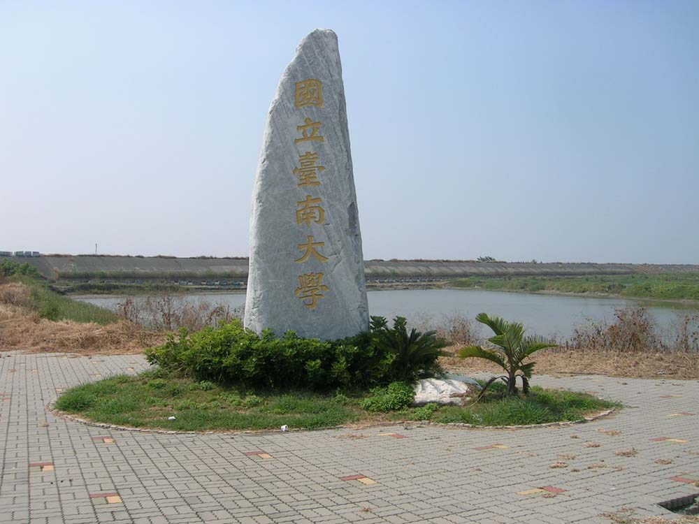 | New Campus of National University of Tainan (NUTN)
The New Campus is located at Xinsheng Section and occupies an area of 83 hectares. After surveying the site, the Ministry of Education (MOE) agreed, on principle, to establish the new campus. The NUTN then submitted proposals and plans to the MOE. In February 2004, President Chen Shui-bian personally visited the site and laid the foundation stone. In October 2005, Minister of Education Mr. Tu Cheng-sheng surveyed the site of the new campus in person and formally declared the approval by the Executive Yuan. Construction of the New Campus formally began in 2006, and the campus was finally completed and moved after 8 years. Construction costs totaled NT$ 5.7 billion, with NT$ 3 billion paid for by the MOE over a period of 8 years. The outstanding sum of NT$ 3.7 billion was listed on the public construction budget by the Executive Yuan and the Council for Economic Planning and Development. It is hoped that the New Campus could help transform the area into a University Town and boost local prosperity |
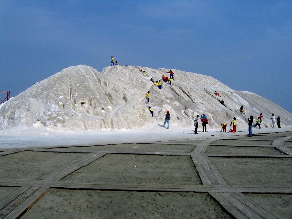 | Cigu Salt Mountain
Cigu Salt Mountain is located at No. 66, Yancheng Borough. The salt mountain is located at the salt drying areas of Cigu salt pans that once belonged to TAIYEN company. The salt mountain occupies an area of about 2 hectares. Its pristine white peak stands tall on the lagoon coast, forming a majestic sight that gave rise to the local name of yanshan (salt mountain). The Salt Mountain is now regarded as a new tourist landmark of Cigu District. |
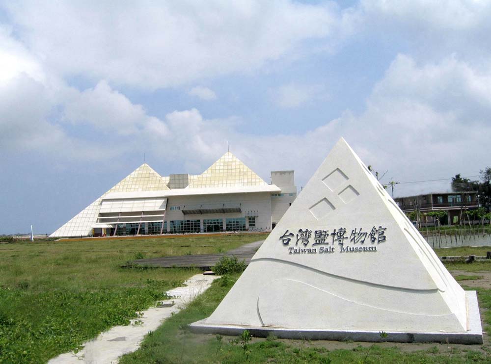 | Taiwan Salt Museum
Taiwan Salt Museum is located next to Cigu Salt Mountain. In 2002, the last of Taiwan's saltpans closed. The TAIYEN company made plans as early as in 1998 to build a museum to preserve the history and culture of Taiwan's salt industry. When the TAIYEN company was privatized in 2004, the Tainan County Government took over the administration of the museum. As significant professionalism is required to operate the museum, the government thus decided to commission museum management via BOT to Yanguang Cultural and Educational Foundation for 2 years. The museum was formally opened to public visits on January 30, 2005. |
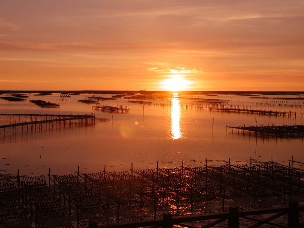 | Cigu Lagoon
Cigu Lagoon is a lagoon formed by the three major backshores of Dingtoue, Wangzailiao, and Qingshangang Barriers as well as the levees of Shifen Borough, Sangu Borough, Longshan Borough, Yancheng Borough, and Xiliao Borough. Cigu Lagoon has multiple important functions, including flood prevention, aquaculture, and eco-tourism. Many fish farmers and fishermen rely on the lagoon to rear their stocks or net their produce. Locals thus refer to the lagoon as the neihaizai (inner ocean) to distinguish it from the true ocean off the coast. Covering an area of 1600 hectares, Cigu Lagoon is Taiwan's largest lagoon. There are 2 tidal entry points through which the waters of the lagoons are exchanged. This living and breathing lagoon serves as a great natural fish rearing area and is home to plenty of ecological resources. Fishing rafts are available to provide eco-tours across the lagoon. All these features attract a great number of tourists every year. |
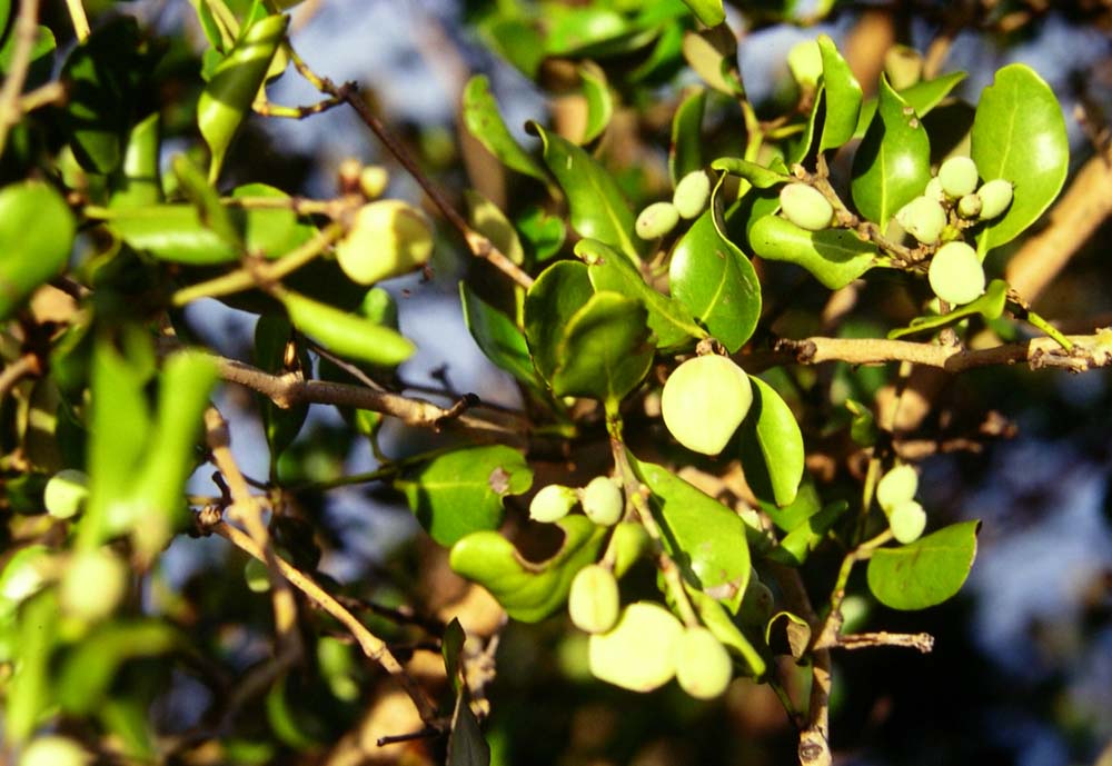 | Mangroves Before emptying into the lagoon, the Cigu River would merge with the Sangu River. The waters would carry a great deal of silt which gradually accumulates to form about 3 hectares of backshores perfect for mangrove growth. The intertidal zones are densely populated by gray mangroves (Avicennia marina). From afar, the deltas appear like emerald islets. With their dense undergrowth and being surrounded on all sides by water, these mangrove thickets are relatively inaccessible to large animals and people. This allows birds, mostly egrets and black-crowned night herons, to safely roost in this location. One may stand at the river levee or bird watching pavilions to observe the numerous egrets and herons roosting in the verdant mangroves. Egrets are day-time animals, while herons are nocturnal. Sunrises and sunsets would be the perfect time to witness the majestic sight of thousands of birds either returning or leaving their nests. |
 | Liukong Tourist Wharf Liukong Shuimen (six-holed water gate, or Number 1 water gate) is located at the southeastern corner of the lagoon and serves as the exit point from waterway No. 13 at the east side of South 38 between the lagoon and the open sea. Liukong Shuimen is located to the north of the Mariculture Research Center of the Fisheries Research Institute, and is referred to as the Liukong Wharf service district by Taijiang National Park. The Wharf is also located opposite Seaside Observation Deck. The docks are established at the eastern side of the levees along the water gate and have been improved upon and expanded by the Tainan County Government (before the official merger) and the Southwest Coast National Scenic Area Management Division to create a recreational wharf of substantial scale for rafting in the lagoon. The wharf is furnished with viewing platforms, ferry piers, and resting areas where visitors could gaze upon the beautiful Wangzailiao and Qingshan Barriers and enchanting sunsets. Oyster beds and nets are scattered throughout the broad expanse of the water bodies. Water to the east side of the Wharf is shallower, forming a wide mudflat once the tide retreats. This is a perfect place to catch Wenge clams and dig for chizuizai (red-footed clams Cyclina sinensis). The Tainan City Government hosts clam-digging events every summer in this area, attracting a huge number of visitors to greatly improve the tourism industry in Cigu District. |
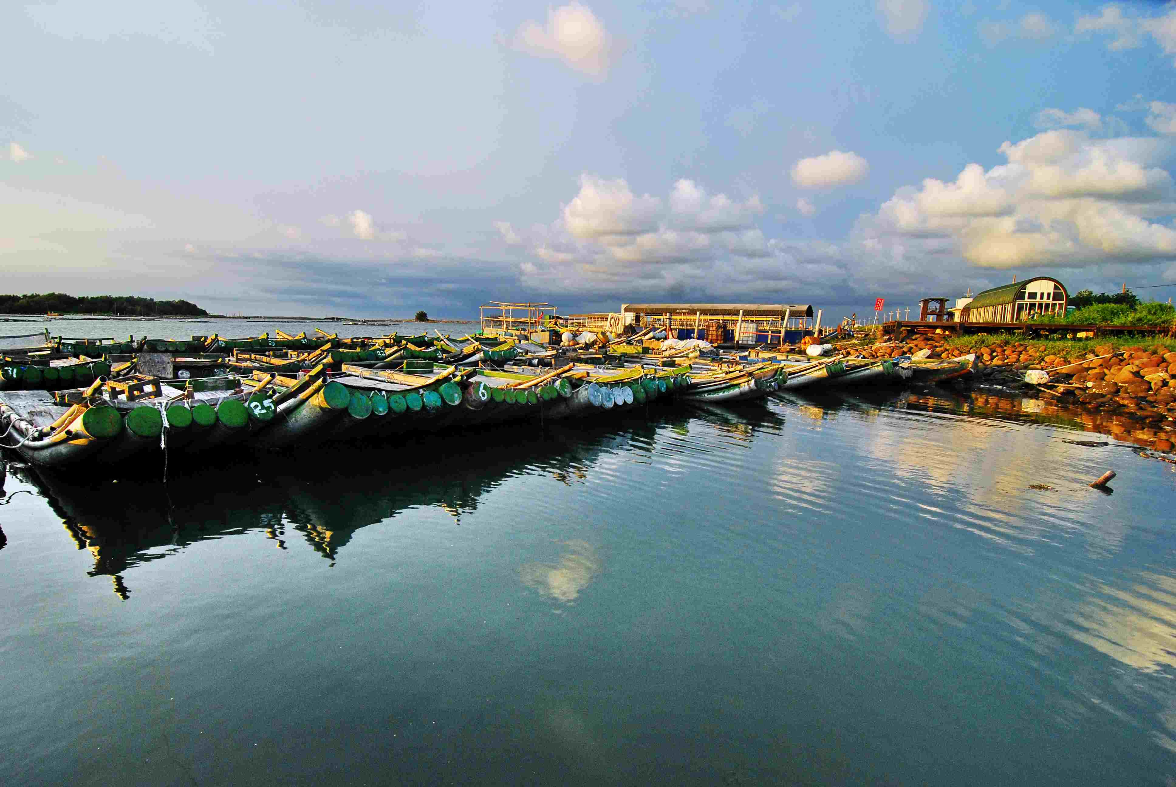 | Nanwan Tourist Nanwan (south bay) is located to the north of Guosheng Lighthouse and is named for being located at the southernmost tip of Cigu Lagoon. The Wharf has been jointly developed by Taijiang National Park and the Southwest Coast National Scenic Area Management Division to form the Nanwan Wharf service district. Dingtoue Barrier is extremely close to Nanwan Wharf, separated only by a stretch of shallow water. Sunsets upon the sparse thickets of windbreaks and rows of common ironwood (Casuarina equisetifolia) form a majestic golden tapestry exclusive to this locale. Numerous tourist rafts and fishing boats are docked at Nanwan Wharf, creating an atmosphere of a small fishing village during dawn and sunset. Tidal retreats during sunsets would expose the Dingtoue Barrier’s intertidal zone. This is the perfect place to observe heshangxie (monk crab, or Mictyris brevidactylus). |
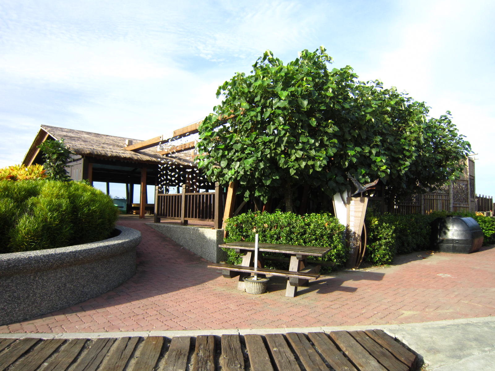 | Black-Faced Spoonbill Reserve and Bird Watching Area The wetland area around the Nanxindi levee along the northern bank of the Zengwen River and the Beijiudi levee at the western coastal embankment is the wintering grounds for the black-faced spoonbill. This region covers a total area of about 634.44 hectares. After years of deliberation to choose between industrial development and ecological conservation, the Council of Agriculture finally announced on October 14, 2002 that the area was to be designated as a “Key Natural Habitat for the Black-Faced Spoonbill.” The western half of the region covering 300 hectares was thus converted to the
“Black-Faced Spoonbill Reserve.” This announcement came into power on November 1,2002 and was enforced by the Tainan County Government. A total of 12 restrictions were promulgated for the nature reserve to ensure proper wetland conservation. In 2007, in order to promote sustainable development of the wetland areas, the Construction and Planning Agency of the Ministry of the Interior (MOI) designated this area as a
“Wetland of International Importance.” On September 28, 2009, the Executive Yuan formally incorporated the areas of ancient Taijiang Lagoon, which also include Cigu Lagoon, into Taijiang National Park. The purpose is to ensure better conservation of the wetland ecosystems as well as the biological and genetic diversity of Cigu Lagoon. The Black-faced Spoonbill Bird-watching Area is a world-class tourist location within Taijiang National Park. To reach this place, go past the black-faced spoonbill ecology exhibit hall to reach Number 1, 2, and 3 black-faced spoonbill bird watching pavilions. The bird-watching pavilions are constructed upon the Jiubeiti levee of the Zengwen River. The 1st and 2nd pavilions are quite spacious and provide parking lots and vendors. A map that marks the roosting sites of the spoonbills is also provided at the entrance plaza. Tour guides are stationed at the pavilion to offer engaging narrations and tours. High-powered binoculars prepared at the bird-watching pavilions would allow people to admire the graceful beauty of the black-faced spoonbills. Spoonbills would rest during the day. Rows of birds stand in shallow coastal waters that come up to their knees at a distance of about 300 to 400 meters away from the bird watchers. These birds would either rest or interact playfully with one another. The spoonbills may also take to the air as the tide comes in or retreats, offering rare opportunities for bird watchers to observe the spoonbills in their graceful flight. There are also many other bird species of various sizes in the black-faced spoonbill roosting areas. Larger birds include the great egrets (Ardea alba), while smaller birds include terns, herring gulls (Larus argentatus), dunlin (Calidris alpina), common greenshank (Tringa nebularia), pied avocet (Recurvirostra avosetta), intermediate egret (Egretta intermedia), and little egret (Egretta garzetta). All these birds co-exist peacefully and share the bountiful food provided by the wetlands. |
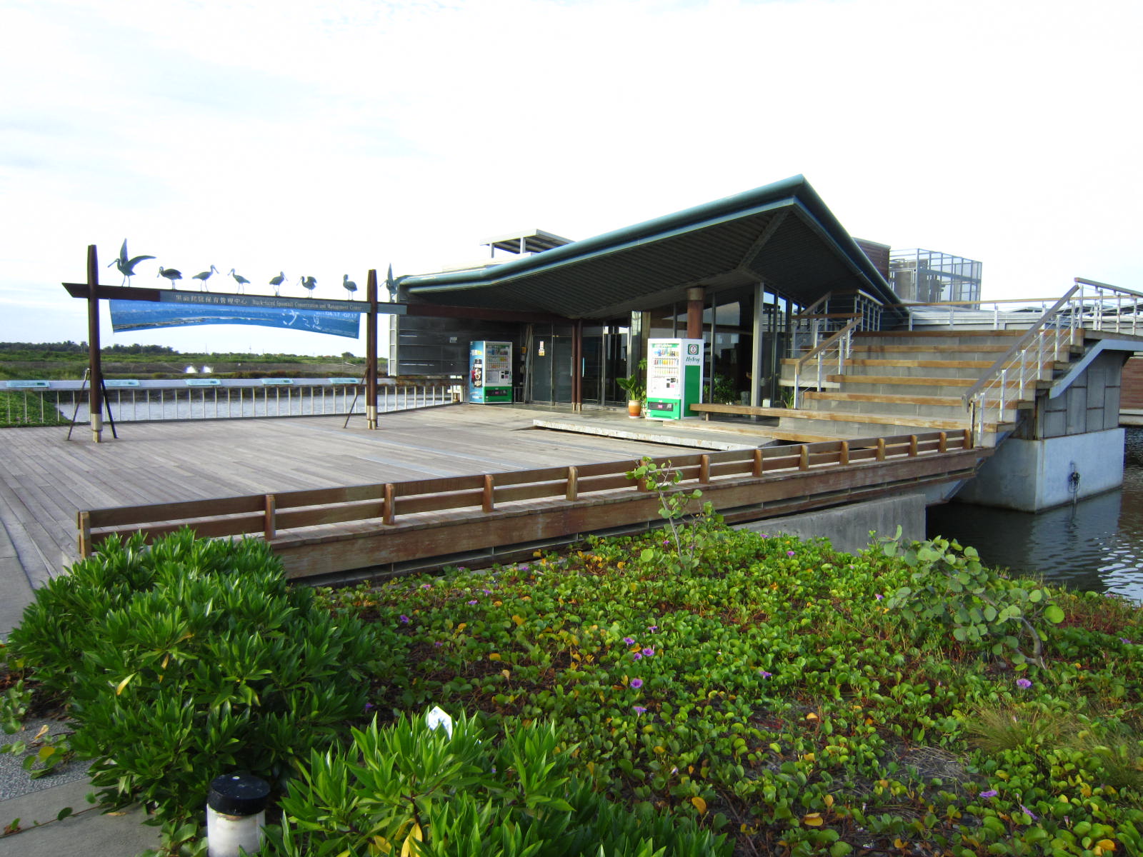 | Black-faced Spoonbill Ecology Exhibition Hall In December 2002, the black-faced spoonbills were threatened by a botulinum poisoning incident. In order to rescue the birds, the Tainan County Government established the Black-faced Spoonbill Conservation Management and Research Center. On December 1, 2009, administration of the Center was passed on to the Endemic Species Research Institute of the Council of Agriculture, which renamed the center as the Black-faced Spoonbill Ecology Exhibition Hall. Visitors at the Black-faced Spoonbill Ecology Exhibition Hall will be able to see stuffed specimen, plastic models, and photographs of the black-faced spoonbills as well as other spoonbill species. The Hall also shows changes to the appearances of the birds during the four seasons, their main diet, changes to their plumage, nesting habits in the north, migratory routes and roosting areas throughout the seasons, and a complete overview of the surrounding ecosystem and environment in splendid and detailed displays. The Hall is also furnished with a multimedia room that plays films on natural ecology, recreational areas, and landscape viewing platforms. The purpose of the Hall is to help visitors easily and comprehensively familiarize themselves with the life cycle of biological history of the black-faced spoonbill as well as the importance of ecological conservation. The administration of the Hall expressed that they will be actively visiting schools and interact with students to hold exhibits and promote ecological conservation programs for black-faced spoonbills and other endemic species. |
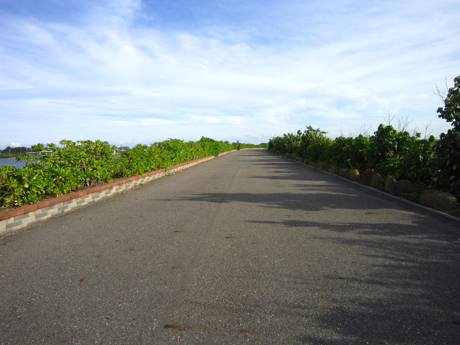 | Cigu Levees The extremely long Cigu Levee is located at the end of City Road 173 to the west of the Black-faced Spoonbill Watching Pavilion and to the south of Shikong Shuimen. The east side of the levee is composed of intertidal wetlands that serve as the habitat of black-faced spoonbills. The west side would be the Xinfulun backshores and Taiwan Strait. Going further south brings us to the mouth of the Zengwen River. Visitors could witness the beauteous sight of the Zengwen River in the morning or enjoy the sunset by taking an afternoon walk or going on a bike ride. Both options offer a wondrous visual experience. Visitors can also go around the levee and then head east for about 2 to 3 kilometers to reach Zhengwangfumiao (Temple of Prince Zheng) of Shifen Borough. The south side of this levee is made up of reclaimed land of the river levee which is now mostly used to grow shallots and garlic. The northern side includes key habitat reservation areas of the black-faced spoonbill and other wildlife as well as
square-shaped fish rearing ponds constructed by fish farmers. Visitors may also see rare Taiwanese fiddler crabs with their large yellow-colored pincers at the tidal channels. The area close to Shifen Borough's great temple of Zhengwangfu (Prince Zheng's Temple) is the new campus of the National University of Tainan. |
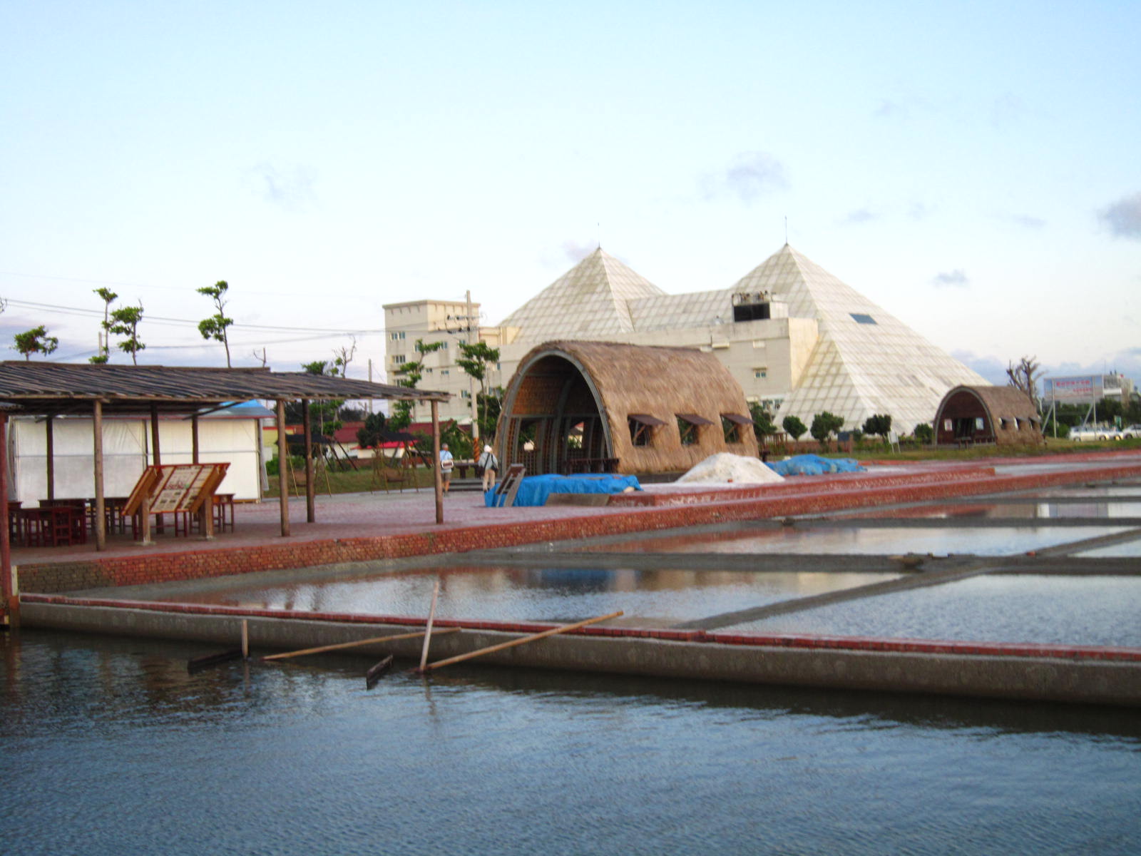 | Taiwan Salt Activity Village This salt pans conservation and activity area has been established to commemorate the Taiwanese salt industry and its 338 years of history. Professional tour guides would lead groups of visitors and introduce them to the salt pans and the process of salt making as well as early windmills and water wheels. Visitors may also personally experience the act of harvesting salt from the Wapan salt pans. Salt-making tools, live salt-making demonstrations, and harvested salt are also exhibited in the area. |
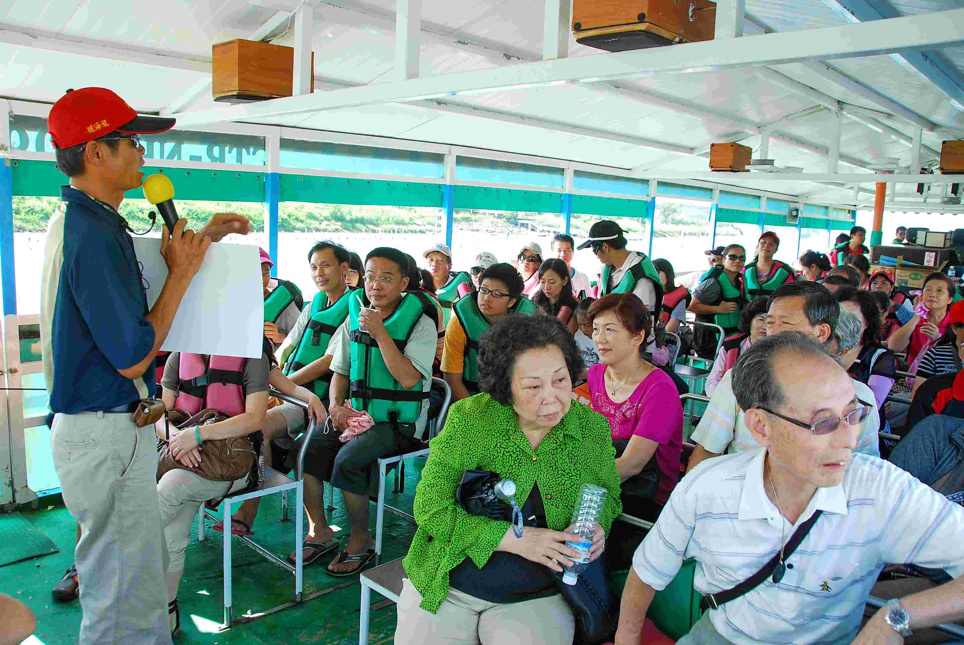 | Fishing Raft Tours Cigu Lagoon is known for its rich aesthetics. Looking at the sights from the levees or taking a relaxing ride on the fishing rafts both offer unique experiences. Fishing raft tours of the lagoon is a key part of the Cigu ecology adventure. Raft owners have established many different trips that offer visitors different experiences and options. A total of 4 wharfs have been constructed along the lagoon. There are currently 12 fishing raft operators that offer the same tours. These 4 wharfs are listed in the following: Longshan Fishing Wharf
Location: Along City Road 176, in front of Longshangong (Longshan Temple) and in Longshan Port.
Tour rafts: The Longshan and Yongshun.
Routes: Longshan Wharf - Hangdao - Lagoon - Wangzailiao Barrier Island - Starting point
Hailiao Tourism Wharf
Location: South 31, the Hailiao East Bridge on the Cigu River
Tour rafts: The Longhai and the Lianqun.
Route: Hailiao East Bridge - Cigu River - Gray mangrove forest – Mouth of the Cigu River - Cigu River Bridge - Lagoons - Wangzailiao Barrier Island - Starting point
Liukong Tourist Wharf
Location: North side of the Beiti Flood Prevention Experimental Center, Liukong water gate.
Tour rafts: The Taijiang and Yonghong.
Routes: Longshan Wharf - Hangdao - Lagoon - Wangzailiao Barrier Island - Starting point
Nanwan Tourist Wharf
Location: North side of the Guoxing Light House, and south tip of the lagoon.
Tour rafts: The Guotai, Dengta, Shunfeng, Ruixing, Hailong, and Haiyang.
Routes: Lagoon Nanwan (south bay) – Dingtoue Barrier - Wangzailiao Barrier Island - Lagoon - Starting point |
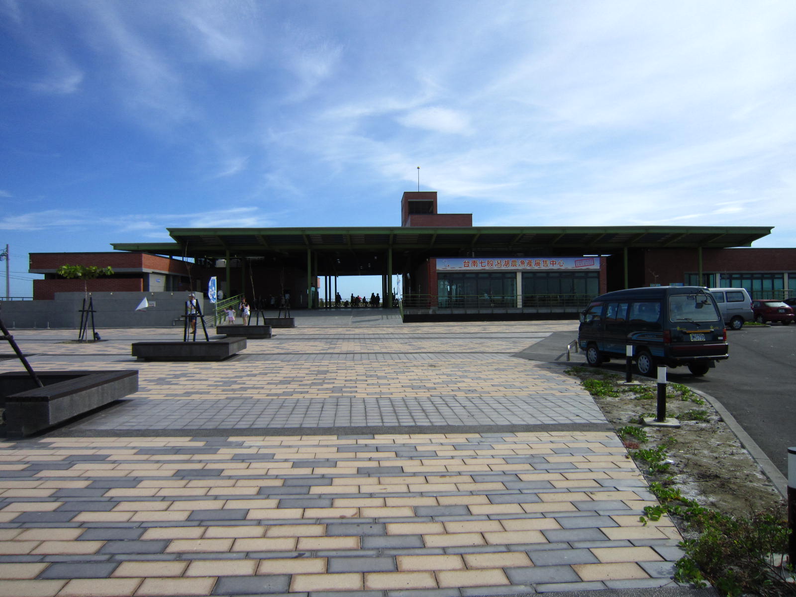 | Taijiang National Park Liukong Management Station Liukong Management Station was formally opened for public visits on December 28, 2010, providing tourists with comprehensive information, tour guides, and consultation services. The Management Station is also provided with a permanent feature exhibit on the ecologies, cultural elements, industries, and resources of Taijiang National Park. Other amenities include the first 3D introduction film created by the National Parks of Taiwan as well as lively digital interactive tour guidance systems. It is hoped that these systems are able to keep up with the times, integrate new technology, and provide a refreshing sensory experience for the visiting public that differs from conventional tour services. |